Providing the Facts on Kansas's Top Topics
Topics
2026 Constitutional Amendment - Supreme Court Judicial Selection
Political Maps
Kansas Congressional Map
Kansas State Senate Map
Kansas State House Map
About
Resources
News
Contact
Topics
2026 Constitutional Amendment - Supreme Court Judicial Selection
Political Maps
Kansas Congressional Map
Kansas State Senate Map
Kansas State House Map
About
Resources
News
Contact
Get In Touch
Home
Political Maps
Kansas State Senate Map
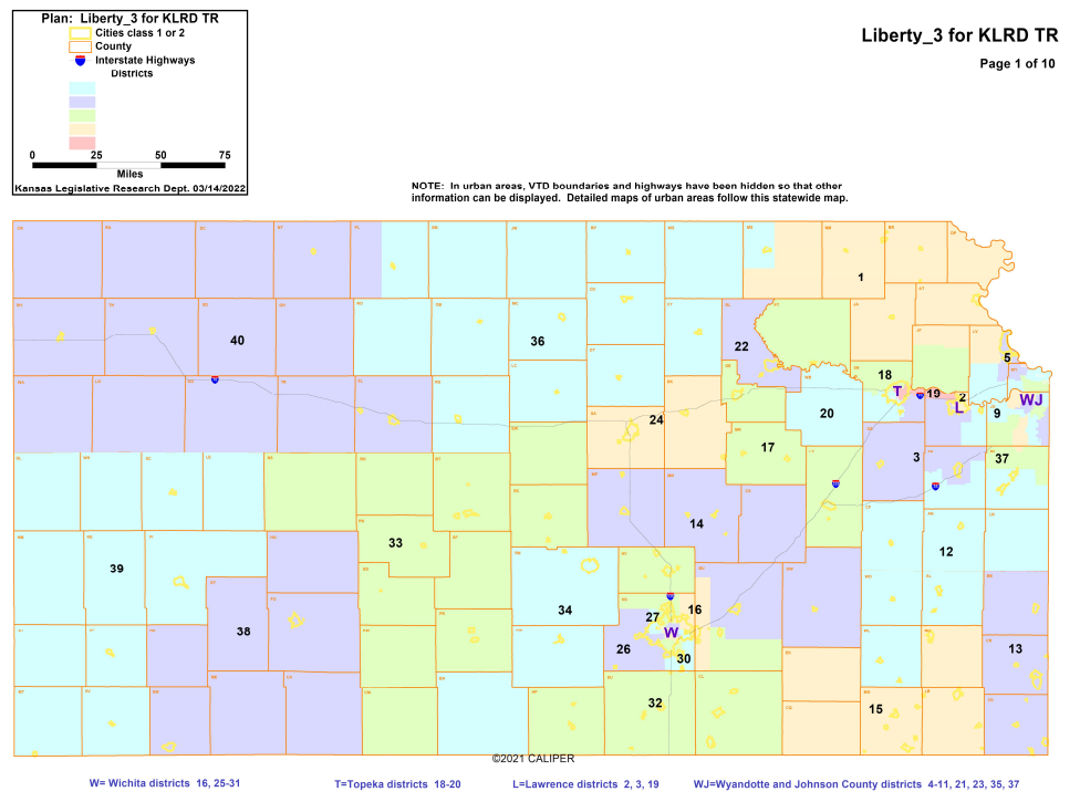
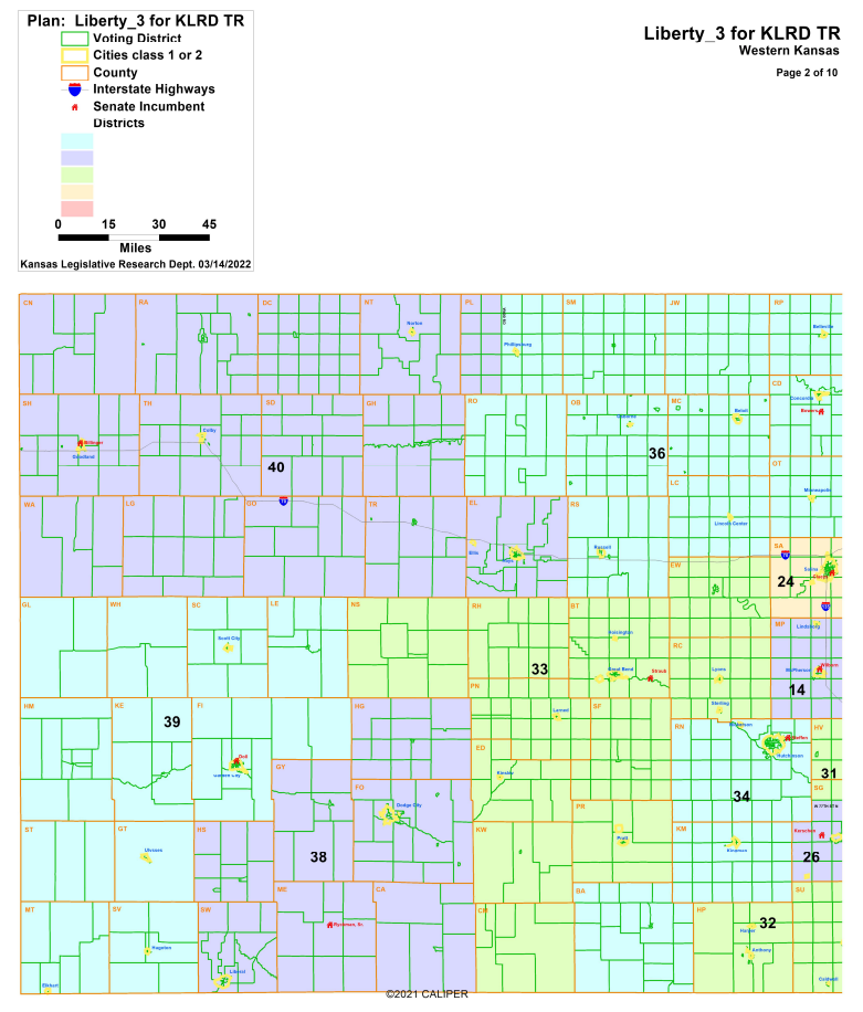
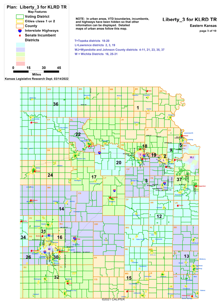
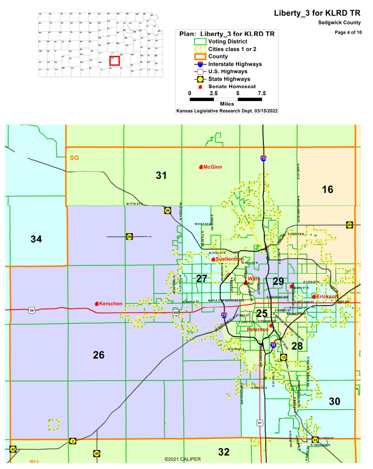
Current State Senate Map for Kansas
Statewide
Western Kansas
Eastern Kansas
Sedgwick County
Topeka
Wyandotte
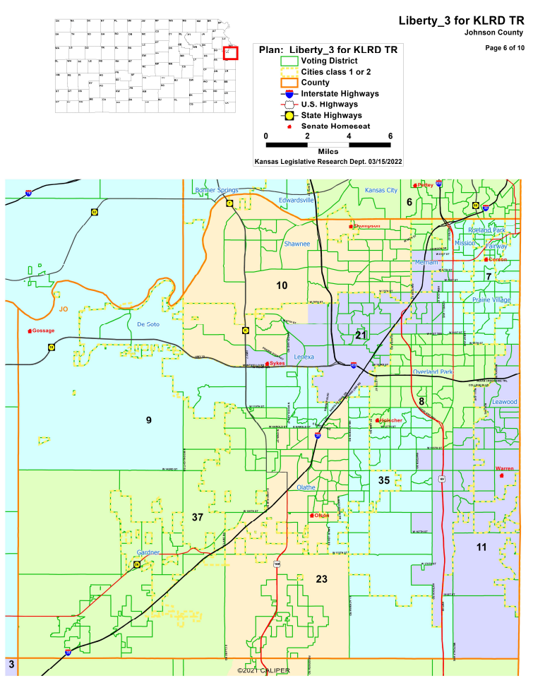
Johnson County
Leavenworth and Wyandotte Counties
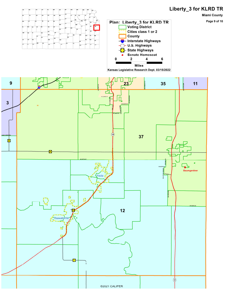
Miami County
Statewide Kansas State Senate Map
View Full Size Map
Back to Top
Button
Detail of Western Kansas - Kansas State Senate Map
View Full Size Map
Back to Top
Button
Detail of Eastern Kansas - Kansas State Senate Map
View Full Size Map
Back to Top
Button
Detail of Sedgwick County - Kansas State Senate Map
View Full Size Map
Back to Top
Button
Detail of Topeka - Kansas State Senate Map
View Full Size Map
Back to Top
Button
Detail of Johnson County - Kansas State Senate Map
View Full Size Map
Back to Top
Button
Detail of Leavenworth and Wyandotte Counties - Kansas State Senate Map
View Full Size Map
Back to Top
Button
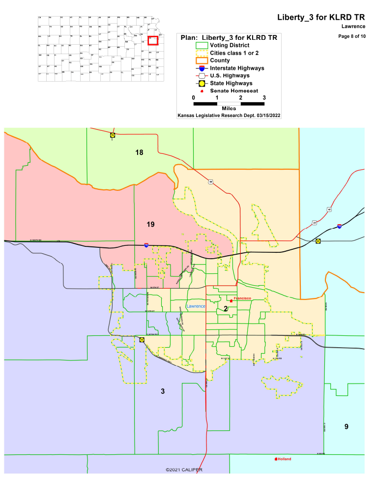
Detail of Lawrence - Kansas State Senate Map
View Full Size Map
Back to Top
Button
Detail of Miami County - Kansas State Senate Map
View Full Size Map
Back to Top
Button